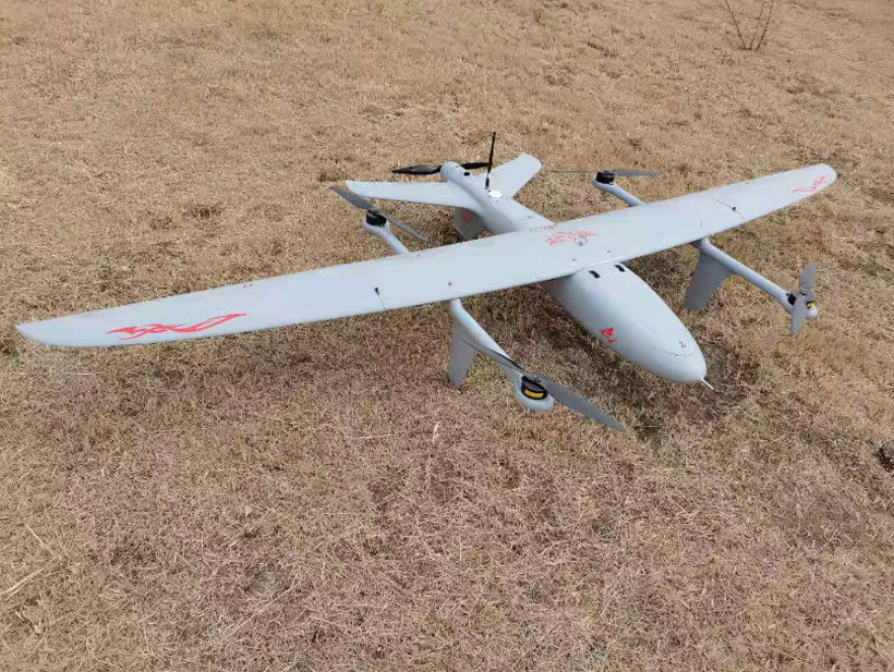


LR01 VTOL Fixed Wing UAV is a professional and high- performing VTOL UAV offering outstanding efficiency and elegance. The system has been designed to quickly and safely integrate different sensors to meet the needs of a variety of fields of application. It can autonomously and safely take off and land vertically with highly sensitive sensors on a minimum area.
With no need for any take-off or landing runways, a pure VTOL aircraft, it is able to vertically ascend to an altitude, where it transitions into forward wing-bound flight for the duration of the mission. Its aerodynamic design as fixed wing aircraft enables a very efficient operation. With low operating costs, non-expensive launch & recovery hardware, there is need for less staffing. Our Electric Vtol Fixed Wing Uav is “value for the money” and competitively priced in its league of UAV’s.
LR01 VTOL Fixed Wing Uav is suitable for:
- Territory Survey & Aerial Terrain Mapping
- Precision Agriculture & Mapping
- Defense & Police Surveillance Services
- Urban Planning
- Forestry Management & Research
- Disaster Site Monitoring & Inspections and many more applications
Features:
- Vertical Take-Off and Landing from any terrain for operations from remote areas
- Full autonomous mission capability with easy to use rugged ground control station.
- Operational ceiling of 3000m AMSL
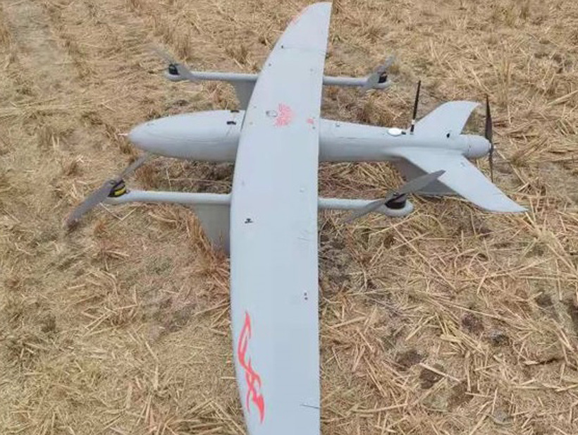
- Advanced composite construction airframe
- Less than 5 cm of accuracy with PPK in ideal conditions.
- Real-time Geo-tagging Trigger Mechanism with downloadable Log file.
- Upto 750 gms of Interchangeable payload options for application specific missions
- Encrypted telemetry and digital video link for long range communication
Payload Options:
- Mapping Camera
- Multispectral Cameras
- Day 10x/ 30x Optical Zoom Camera, Night Thermal sensor
Specifications
Size | Span/Length | 2.5M/1.6M |
Weight | Uav | 8.5 Kg |
Range | In Kilometers | 5+ km |
Coverage Area (single flight) | In Kilometers | Upto 5 sqkm, flying at 120 m |
Ceiling | In Meters | 3000 Amsl |
Endurance | In Minutes | 90 minute configurations |
Cruise Speed | In Km/H | 60 Km/H |
Maximum Speed | In Km/H | 90 Km/H |
Take Off Mode | Autonomous Vertical Takeoff And Fixed Wing Conversion |
Recovery Mode | Conversion From Fixed Wing To Autonomous Vertical Landing |
Payload | 24 MP Sony Alpha A-6000 with trigger mechanism Micasense Rededge X |
Payload Platform | Fixed Bottom Mount |
Propulsion Type | Electric Motor (Non-Audible Beyond 200m) |
Operating Altitude | 100m-1000m Agl |
UAV Modes | Auto Take-Off Navigation Modes: Path, Loiter, Semi Circle, Geo Survey Auto Landing: Defined Point Fully Autonomous Touchdown Smart Return to Home |
Battery Charger | Ac/Dc Multi Input Balance Charger |
Fail Safe | Return Home And Autonomous Safe Landing For Emergencies Like Low Battery, Loss Of Communication |
Packing/Portability | Portable By Two Men, Rugged And Water-Resistant Backpack |
GCS | Single User License Included User-Friendly Interface NPNT Compliant Software Laptop Not Included |
Display | Map 2d (Standard Image Types: Tif, Jpeg, Gif) |
Waypoint Navigation | 256 Points Dynamically Programmable |
Battery | 22000 mAH Lithium Polymer |
Sustainable Landings | 500+ For Structure |
Optional Equipment’s | PPK/ RTK Gps Base Station |
Packaging | Standard Rugged Case Or Light Weight Rugged Case Or Water Resistant Backpack |